Reports, Studies and Publications
MMI Watershed Assessment Reports
A severe precipitation system in June 2013 caused excessive flow rates and flooding in a number of communities in the Herkimer-Oneida Counties region. As a result, the New York State Department of Transportation (NYSDOT) in consultation with the New York State Department of Environmental Conservation (NYSDEC) retained Milone & MacBroom, Inc. (MMI) to undertake an emergency transportation infrastructure recovery water basin assessment of 13 watersheds. Work conducted for these studies included field assessment of the watersheds, streams, and rivers; analysis of flood mitigation needs in the affected areas; hydrologic assessment; hydraulic modeling; and identification of long-term recommendations for mitigation of future flood hazards.
Flood Hazard Mitigation Plans
A number of Flood Hazard Mitigation Plans have been developed at both the County and local levels. In Herkimer County, the Planning Department has developed “Multi-Community Flood Hazard Mitigation Plans” that are based on watershed boundaries and involve multiple communities in one plan. These plans focus on non-structural flood control alternatives.
Mohawk Greenway Project
The Oneida County Department of Planning is involved in a project to develop a Comprehensive Greenway Plan for the Mohawk River Corridor within Oneida County. The project is made possible through a Quality Communities grant provided by the NYS Department of State with an in-kind match provided by Oneida County . The NYS Department of Transportation and NYS Department of Environmental Conservation are key agency partners in the project.
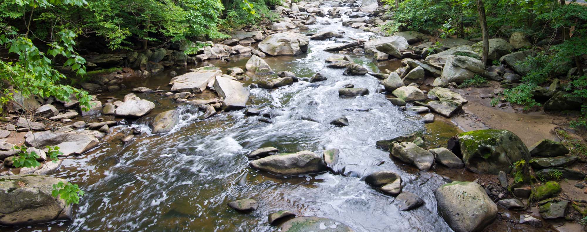
Sauquoit Creek Basin Watershed Management Program
A six volume report that provides a holistic, intermunicipal and basin wide approach to water resources management and incorporates all water resource issues, discusses the issues' interrelationships, and identifies common solutions. As part of the activity, a basin coordinating committee was formed to develop a water resources management strategy for the basin. The strategy details future needs and outlines funding-ready projects.
Oneida County Environmental Assessment and Plan
A comprehensive plan which identifies key environmental resources within the county. The report includes textual descriptions of environmentally significant resources and provides a series of maps depicting the locations of these resources.
Canal Plan for the Mohawk Valley Region
The plan was developed to provide the NYS Canal Recreationway Commission with the input necessary to develop the Statewide Canal Recreationway Plan. The Mohawk Valley Regional Canal plan covers an area which includes a 1/2 mile corridor on each side of the Erie Canal, beginning at a point just east of Amsterdam in Montgomery County and extending through Herkimer County to Oneida Lake in western Oneida County. The plan provides the framework necessary to encourage economic development and to direct growth in tourism and recreational use of the canal.
Mohawk River Floodplain Study
Past efforts in flood mitigation planning programs resulted in the development of the Mohawk River Study which provides a plan for flood plain management along the entire Mohawk River corridor throughout Oneida and Herkimer Counties.
Hinckley Reservoir Study
The study was undertaken to establish a broad database of environmental and land use conditions around the Hinckley Reservoir and to define major land use issues associated with development. The study report suggests a number of regulatory measures and policies which could be implemented to address many of the identified concerns.
Hinkley Reservoir Study May 1989 (PDF)
Southern Reservoirs Study
Given the discontinued use of and the unique urban location of the Southern Reservoirs' site within the City of Utica, a study was undertaken to investigate potential reuse for recreation and/or housing.
Southern Reservoir Study (PDF)
Oneida County Water Resources Strategy
A comprehensive plan which: identifies water resource priorities within the county; lists federal, state, and private sources of potential funding programs; and, identifies key contacts and agencies within the water resources field.
Local Wellhead Protection Studies
A study of twenty-one individual community water systems which rely exclusively on ground water as a source of supply. Provides an in-depth inventory of resources and potential threats, defines multiple wellhead protection areas, and provides recommendations on wellhead protection alternatives.
Local Groundwater and Wellhead Protection Implementation Program
A report summarizing assistance to seven communities in developing and implementing specific wellhead and/or ground water protection regulations based on recommendations and information contained in the "Local Wellhead Protection Study."
Oneida Lake Watershed Management Project
The Regional Planning Program has assisted the Central New York Regional Planning Board in many aspects of the Oneida Lake Watershed Management planning project. The key elements of the project include the development of a State of the Basin Report and a Lake and Watershed Management Plan.
HOCCPP has served on many of the sub-committees that have been formed over the duration of the project. Extensive technical assistance has been provided with regard to the development of the plan framework, draft by-laws, and formation of the Oneida Lake Watershed Advisory Council.
HOCCPP was also responsible for the creation of numerous GIS data layers and mapping relating to the analysis of land use within the watershed, natural resources within the basin, and socio-economic characteristics. Sample mapping and additional links are provided below.
Comprehensive Water Management Study for Herkimer and Oneida Counties
A series of four composite maps of "constraints" and "inventory" information for the two counties which includes water resources and other natural resources information such as, but not limited to: wastewater discharge points; public water supply intakes; water treatment facilities; water lines and districts; water quality monitoring stations; gauging stations; major and minor drainage basin boundaries; floodplains; steep slopes; agricultural districts; classified streams; etc.
Rural Water Supply Study
Provides an investigation of the three major public water supplies and over thirty smaller water systems in the two county area to appraise these water resources and determine how they should be developed to provide for future needs. The report (and subsequent updates) include a description of basic features of each system with estimates of capital and annual costs, and also, suggests methods of organizing and financing major facilities.
Groundwater Availability in the Mohawk River Basin and Southern Herkimer County
Cooperative effort with both the US Geological Survey and the NYS Department of Environmental Conservation to develop a series of three plates depicting the availability of ground water from unconsolidated deposits within the Mohawk River Basin. The information includes: location and yeild of wells; surficial geology; and the estmated potential well yields.
Water Resource Planning and Projects
The Water Resources Planning Program in Herkimer and Oneida Counties is primarily supported by funding made available through the Federal Clean Water Act via the US Environmental Protection Agency and NYS Department of Environmental Conservation.
The continuation of this funding has been a major contributing factor and catalyst which helps to solidify the Regional Planning Program's involvement in water quality and watershed management planning activities.
Staff continues to assist a number of communities with the investigation and implementation of wellhead and watershed protection controls. The regional planning program is also involved in programs related to: community flood mitigation planning, source water assessment, and other miscellaneous projects and programs.
For additional information regarding any of these programs, please contact the Herkimer-Oneida Counties Comprehensive Planning Program staff at planning@ocgov.net or (315) 798-5710.